Bibliography


Automatically generated translation
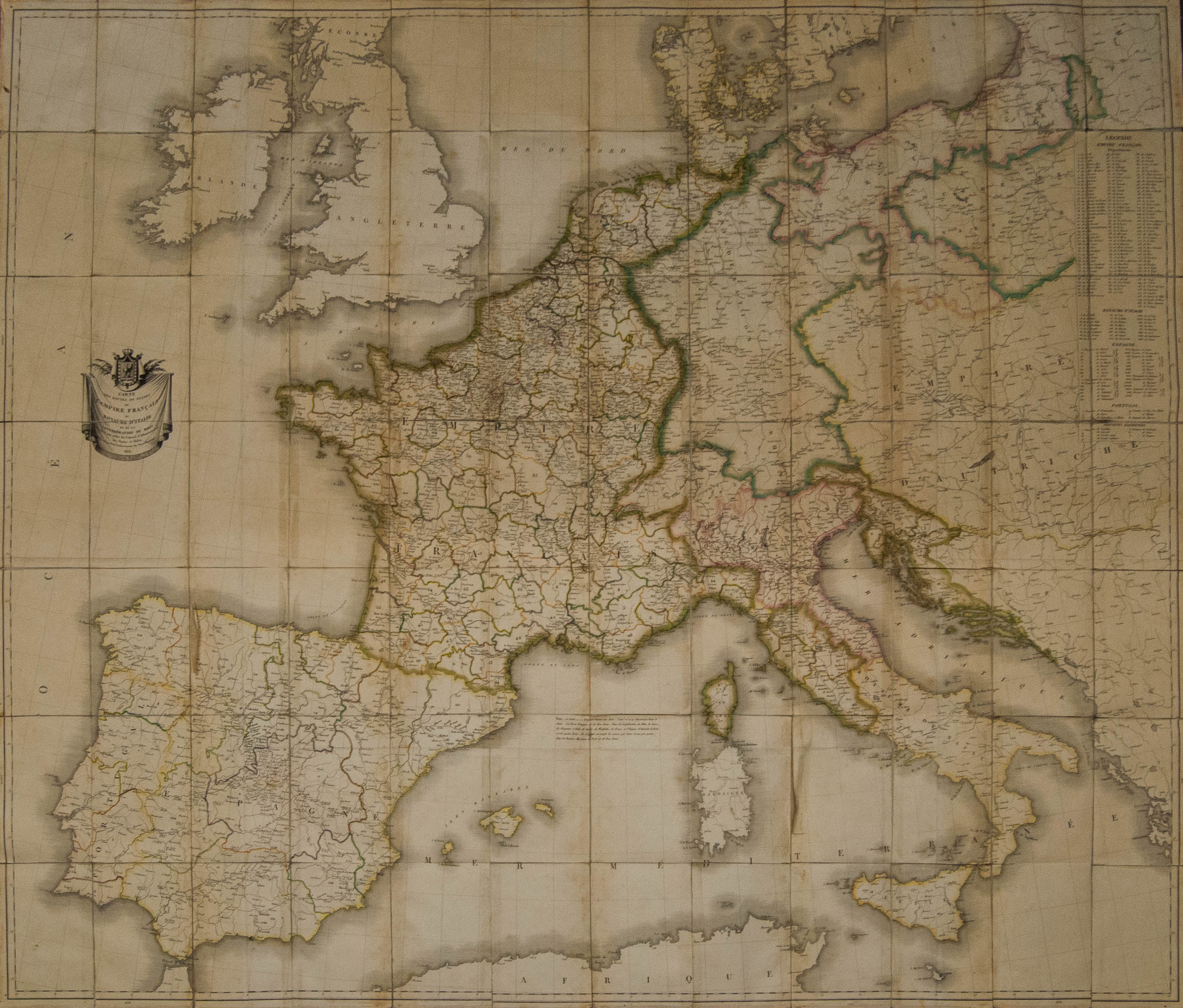
 1812. Map of the Postal Routes of the French Empire, the Kingdom of Italy and the Confederation of the Rhine. Paris, 1812. By Tardieu (140 cm x 121 cm). MAGNIFICENT AND VERY RARE EUROPEAN-NAPOLEONIC MAIL MAP, WHERE NAPOLEONIC'S INTEREST IN SHOWING THE COMMUNICATIONAL COHESION OF HIS VAST EMPIRE IS DEMONSTRATED.
![]() White box
White box
![]() 520g
520g
Price 1.200€
Illustrative price in other currencies
-
 $ 1.356
-
 £ 1.029
-
 CHF 1.117